
Town of Silverhill about 1910-1912 with labels. The road is highway 104 looking west.
|
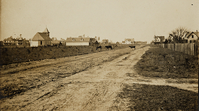
Town of Silverhill about 1910-1912 without labels. The road is highway 104 looking west.
|
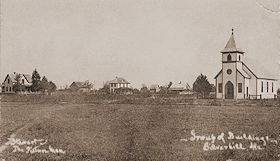
Town of Silverhill looking northeast.
|
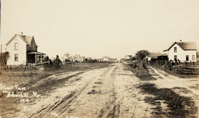
Town of Silverhill 1910. The road is highway 104 looking west.
|

Town of Silverhill about 1931 with labels. The road is highway 104 looking east.
|
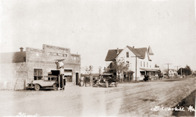
Town of Silverhill about 1931 without labels. The road is highway 104 looking east.
|
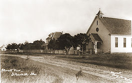
Baptist Church and Parsonage about 1910, looking SE. Mission Church far left. Road is Highway 104.
|
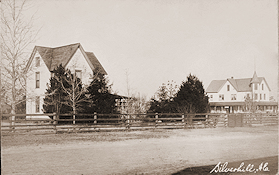
Oscar Johnson's house on the left about 1907. Silverhill Hotel built by Charles Olander on the right. The camera view is from the side porch of the Peoples Supply looking northwest. The dirt road would become County Road 55.
|

The Hotel Norden and Annex about 1915. Peoples Supply is in view on the right. The road on the right is County Road 55. The road running to the left is 4th Avenue.
|
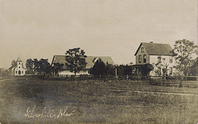
Mission Church, People's Supply, and Oscar Johnson Home about 1907-1908, looking SE.
|
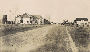
View of Silverhill in about 1920 looking north, shows the following buildings on the left side of the street; Hotel Norden then the hotel annex. On the right side of the street, the nearest building is the home of Charles Hoff, then his blacksmith shop. Past that is the back of Peoples Supply. This dirt road would become county road 55.
|
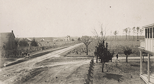
View of Silverhill looking south down County Road 55 from the second story of the Norden Hotel Annex building about 1920. The road to the right is 4th Avenue leading to the Silverhill schoolhouse two blocks away.
|
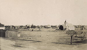
View of Silverhill in about 1920 looking northeast from the top story of the Hotel Norden annex. On the right is the Mission Covenant Church with people gathering for a meeting. To the right of the church is the home of Dr. O.F.E. Winberg. To the left of the church is the home of Henry A. Wilkes. On to the left past the barn, is the home of John A. Isackson.
|
|